Staring at a topographical map of Bear Canyon trail I daydreamed about what a scenic route this would be. All that elevation and through a canyon – I love canyons! Surely the views would be incredible! I was sold.
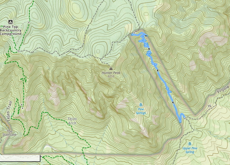
Table of Contents
Unfortunately, I did not enjoy my first ascent of Bear Canyon Trail because I did not realize what a true leg burner it was. As a bitter old animated lion once said, be prepared!
Recommended Supplies
Minimum recommended supplies per person
- 2L water
- Rain jacket
- Sunscreen
- Sun protective clothing and hat
- 300-700 calories of food/snacks
- Paper map
- Hiking poles
Trailhead(s): Pine Springs, Frijole Ranch
Hiking Bear Canyon Trail: 1.8 Miles One Way
Unfortunately, yours truly failed to do any pre-hike homework on this trail other than to fantasize about it while staring at a topo map and dreaming about “how cool” it would be. You’re here and reading this article, which makes you a hell of a lot more prepared than I was.
Good job.
This fucking trail gains 2,000 feet of elevation in less than 2 miles (the trail is only 1.8 miles long), a fact my legs alerted me to very early on in my trek.
Accessing Bear Canyon Trail
But before I get into too many piddly complaints, let’s dive into the details. As noted, Bear Canyon is 1.8 miles long one way and gains approximately 2,000 feet of elevation if ascending (duh).
But here’s the kicker, Bear Canyon can’t be accessed directly. You have to work to even get there.
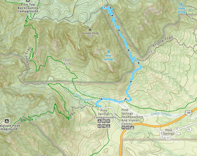
From Pine Springs
From Pine Springs Trailhead you can take the Tejas Trail to Frijole Trail to hit Bear Canyon. That’s 1.6 miles of hiking to reach Bear Canyon Trail. This gives you a one way trip of 3.4 miles.
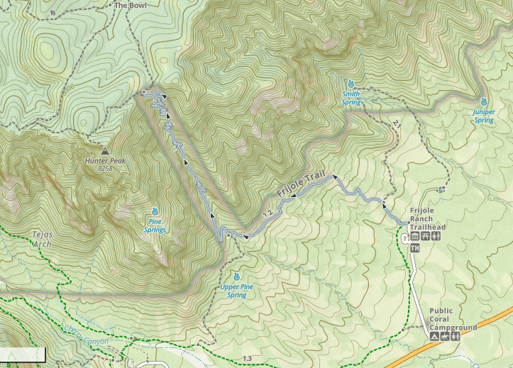
From Frijole Ranch
Alternatively, you can start at the Frijole Ranch trailhead, which is 1.4 miles of hiking to reach the trailhead. This would give you a one way trip of 3.09 miles.
The Route I Picked
When I did this hike the first time, I started at Pine Springs and hiked to Tejas, then to Frijole Trail. From there, I quickly made my way to Bear Canyon. There’s not a lot to say about that section, which I guess kind of says it all. Awkward.
Tejas Trail crosses a white rocky wash, which is a pain in the ass to walk across and sometimes hard to find the way through (look for cairns). I get confused in this section every time I do this fucking trail.
Since both of my forays along Bear Canyon Trail have been via Pine Springs, my trail description is going to focus on that route.
Ascending to Bear Canyon from Pine Springs Trailhead in Detail
From Pine Springs, you set out to the right, away from the main action of the Guadalupe Peak and Devil’s Hall Trails. Who needs those overrated mother fuckers, anyhow? Not you. You’re out for triumph over Bear Canyon. Hoorah.
Take Tejas Trail/The Foothills Trail to where it T-bones with Frijole Trail and take a left on Frijole Trail (assuming you’re ascending Bear Canyon).
Frijole Trail gains a very small amount of elevation, but the trail is relatively flat underfoot and easy to walk on. It runs through scrubby desert and has very little tree cover.
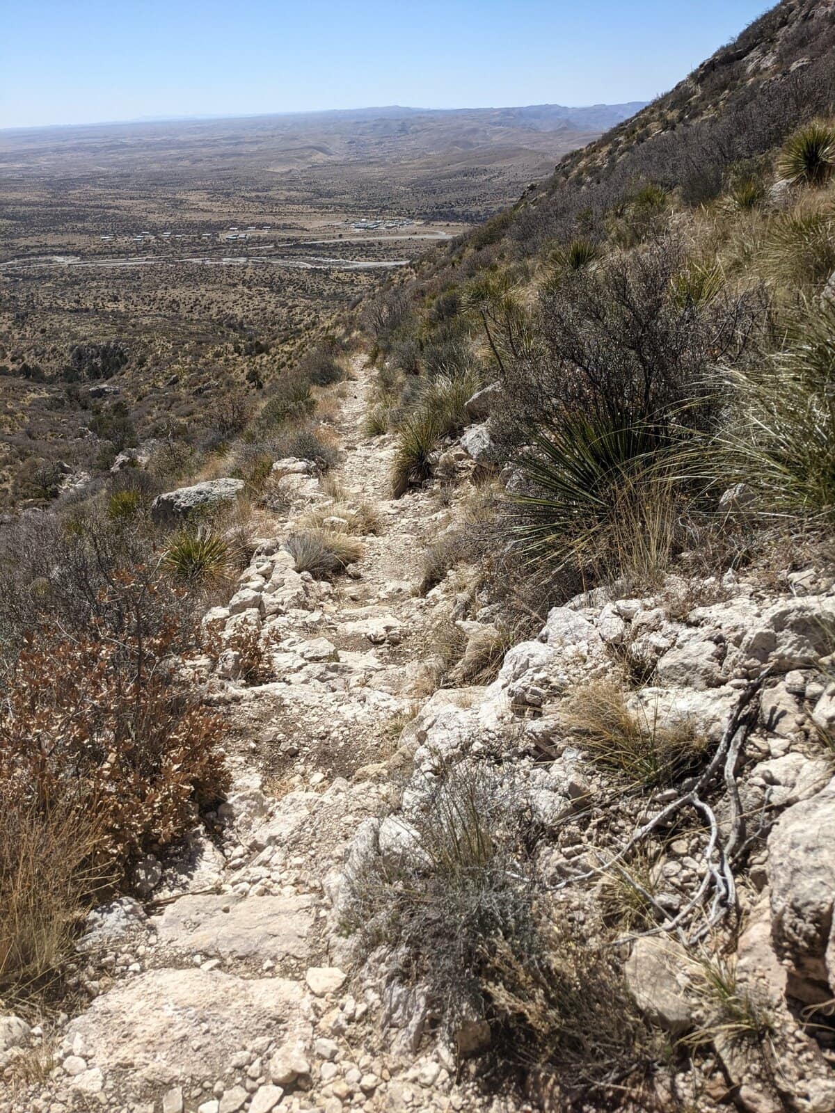
On my second foray to Bear Canyon (descending, instead of ascending), I was on Bear Canyon and Frijole Trail in the early afternoon and my skin was not happy about the merciless sun situation (I may not have packed enough sunscreen, either).
If you’re expecting to be in that area under the Texas sun, wear protective clothing and/or slather on ungodly amounts of sunscreen.
Follow Frijole Trail for 0.9 miles. At this point you are finally at Bear Canyon Trail! Frijole Trail continues on straight. Forget that lil bitch. You have bigger and better things to conquer. Take a deep breath, shake out those legs and take a left.
Bear Canyon Trail from Frijole Trail
One thing I do have to say in favor of Bear Canyon Trail is that it’s hella easy to navigate. There’s only one way up and no trails turn off of it – pretty impossible to get lost.
The first time I did this hike was in March and I enjoyed temperate weather, hanging out in my favorite Prana pants and a tank. On my second trip (this time down) Bear Canyon, it was late September around 12pm as I picked my way down the slope.
Wear Sunscreen
As I mentioned, I was fully exposed to the sun and hot temperatures. This is definitely not the trail to be on in temperatures above 90 degrees, especially because there is very little tree cover. The trail is on the face of the eastern escarpment, which means that the midday sun really gets you.
As you gain elevation, the temperature drops pretty significantly but it’s going to take a fat minute for you to actually get there, so don’t count on that to cool you off.
Bear Canyon Trail Observations
The trail winds up a canyon (who would have guessed?) with a series of short switchbacks and some big, rocky step ups.
There is an old water pipe that runs down the canyon intermittently, a remnant from the ranching days of this area. At the top of Bear Canyon is the stock tank that this pipe used to connect to.
There are also a few interesting rocky overhangs along the way, which would make nice picnic spots if you’re inclined to take an extended break.
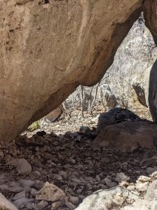
Overhang on Bear Canyon
The air is dry, crisp and clean.
Of course, on my way up I had a hard time fully absorbing these details thanks to the screaming agony in my legs and lungs.
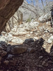
Great spot for a picnic!
Is Bear Canyon Trail popular?
Well, on my way down Bear Canyon on trip #2, I encountered mountain lion scat, which scared the shit out of me. So the big cats don’t hate it. Thankfully, I didn’t see any actual mountain lions.
As far as people go, they’re pretty scarce as well.
On my first time on Bear Canyon, I didn’t see a single other soul on the trail. On my second journey, I passed a total of 3 groups ascending, so I think it’s safe to say that this trail isn’t exactly what you’d call “popular”.
The Summit of Bear Canyon Trail
When I finally dragged my carcass up those 2,000 feet to the top, I was rewarded with panoramic views of the mountains below and a nice whipping wind in my face.
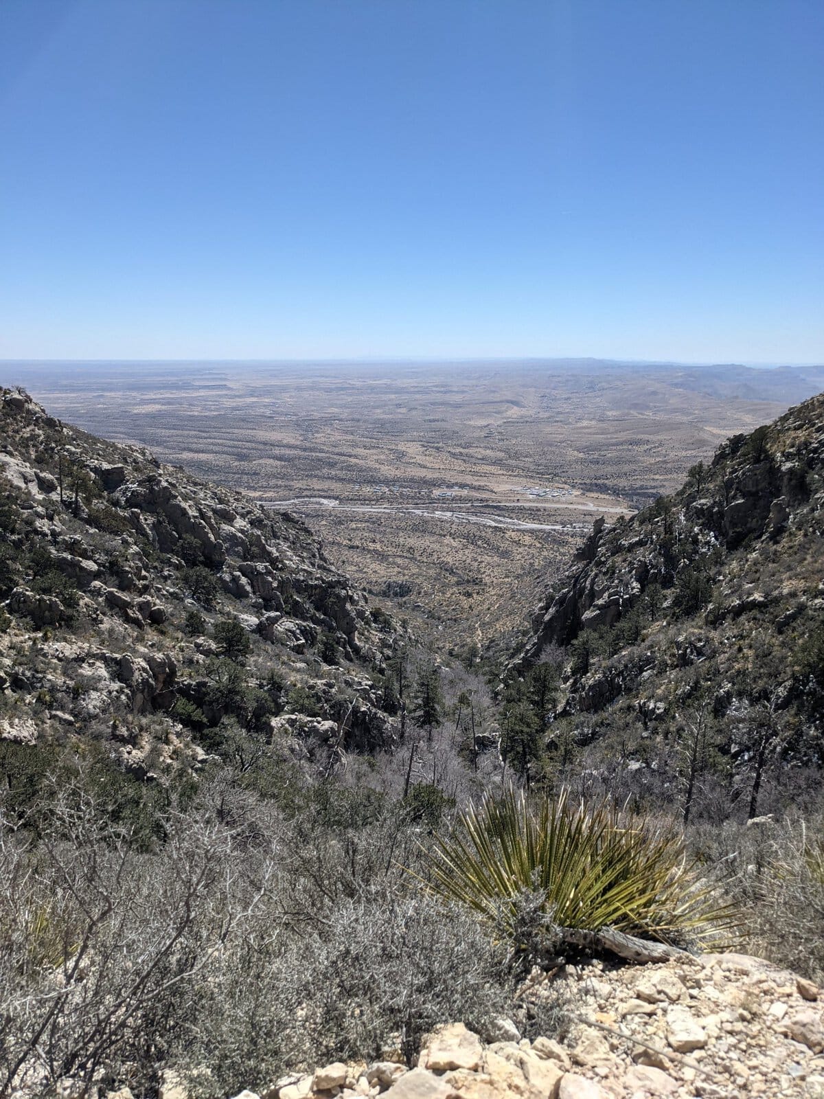
There were a variety of small and convenient boulders nearby, upon one of which I quickly plopped my sorry ass. I then proceeded to stuff my face with PB & honey sandwiches while trying to allow my legs to recover from this intense hike.
A Note on Descending Bear Canyon
The second time I took Bear Canyon Trail (as noted, descending instead of ascending) I enjoyed the views a lot more since they were right in my face as I trekked down the slope. Somehow they felt easier to enjoy that way, rather than having to turn around to take them in as I did on my way up.
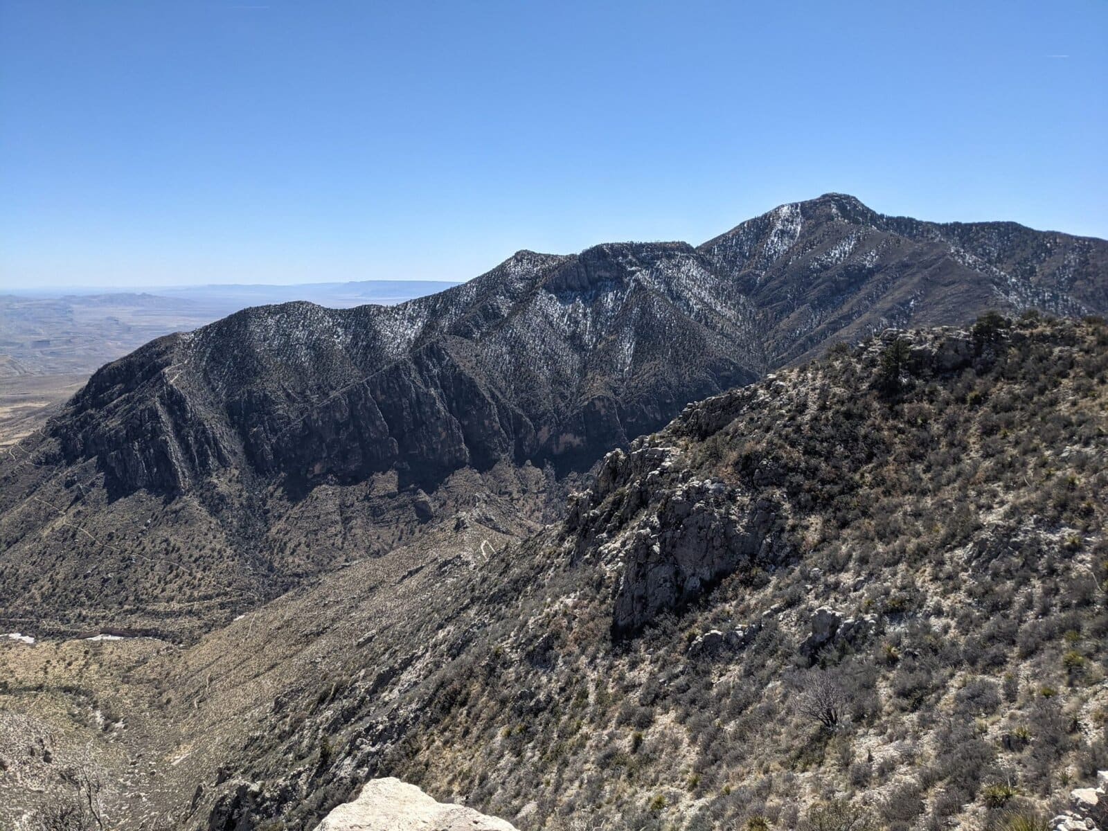
That said, you should know that going down Bear Canyon isn’t particularly easy. In fact, the National Park Service page says that the rangers recommend you ascend rather than descend this trail.
Now I know I’m a slow descender, but it took me 44 minutes to get down that first mile of Bear Canyon Trail. It’s so damn steep and some of the step downs are so fucking big.
If you’re going down, plan on taking your time and be safe.
Final Thoughts on Bear Canyon Trail
From the top of Bear Canyon, I took the Bowl trail to Tejas trail back to Pine Springs trail for a total of about 9 miles. Once I was up Bear Canyon, this was a hike I really enjoyed.
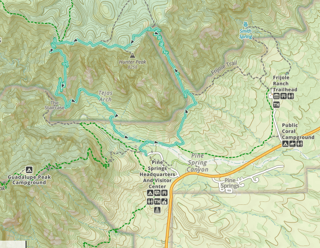
Pine Springs to Bear Canyon to the Bowl to Tejas.
While I wouldn’t recommend this trail simply for the sake of doing it, and definitely not as an out and back, it’s a good trail to use for the purposes of linking with the Bowl Trail, Tejas Trail or Juniper Trail and the view at the top is pretty awesome. Be prepared to work really hard pretty much this entire trail, be exposed to the sun and see some pretty cool rocky landscape!
In certain circumstances, would recommend.
Too Long: Didn’t Read;
- Bear Canyon cannot be accessed directly from a trailhead but must be hiked to from Tejas trail to Frijole trail
- 1.8 miles one way, 2,000 feet of elevation! Very hard!
- Not a particularly scenic trail, especially while going up, but the view from the top is great
- Minimal shade cover; be prepared for direct sun exposure
References
